Identity area
Reference code
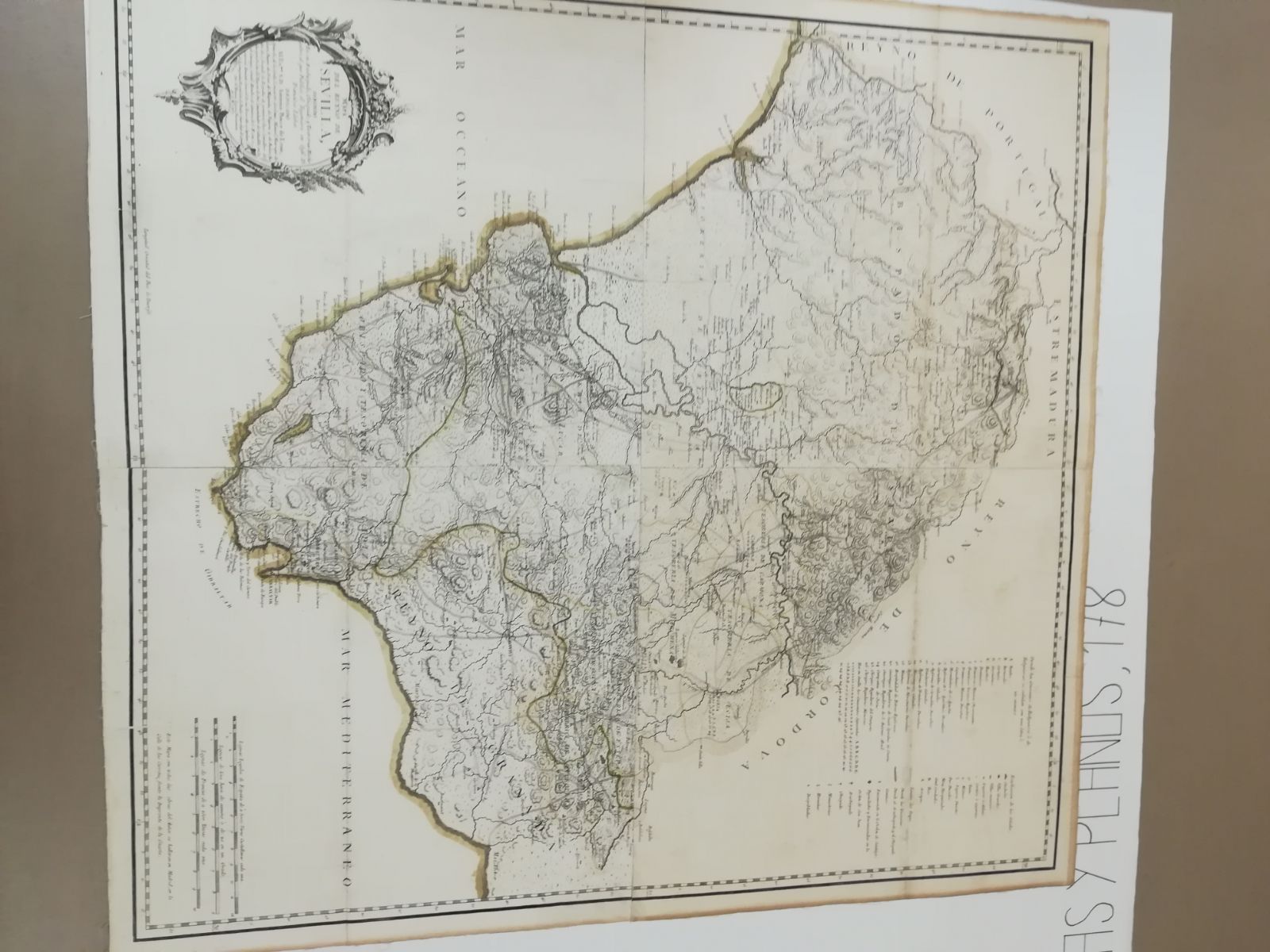
ES.41063 24/178
Title
SEVILLA: Mapa del Reino de Sevilla
Date(s)
- 1767 (Creation)
Level of description
Item
Extent and medium
1 plano [ 81 x 76 cm] Papel tela
Context area
Name of creator
Biographical history
Archival history
Immediate source of acquisition or transfer
Content and structure area
Scope and content
Mapa del reino de Sevilla dividido en arzobispados, obispados y tesorerías hecho sobre el que publicó el ingeniero jefe Francisco Llobet dedicado al Señor Antonio Ponce de León realizado por Thomás López. Incluye leyenda explicativa en el ángulo 2 y signos de los lugares destacados, conventos, ciudades, villas, caminos, arzobispados, obispados y encomiendas.
Appraisal, destruction and scheduling
Accruals
System of arrangement
Conditions of access and use area
Conditions governing access
Conditions governing reproduction
Language of material
Script of material
Language and script notes
Physical characteristics and technical requirements
Finding aids
Allied materials area
Existence and location of originals
Existence and location of copies
Related units of description
Notes area
Note
- Thomás López. Cartela con orla de flores conteniendo el título en el ángulo 3.
Alternative identifier(s)
Access points
Subject access points
Place access points
Name access points
Genre access points
Description control area
Description identifier
Institution identifier
Rules and/or conventions used
Status
Level of detail
Dates of creation revision deletion
Septiembre de 2004
Language(s)
Script(s)
Sources
Archivist's note
Guillén Carranza, Pilar. Ayudante de Archivo
Digital object metadata
Filename
MPD_0178_Provincia_1767.jpg
Latitude
Longitude
Media type
Text
Mime-type
image/jpeg
Filesize
225.4 KiB
Uploaded
January 25, 2021 8:12 PM